- Distance: 90 km
- Elevation gain/loss: +1021/-1818 m
- Region: Emilia Romagna
- Period: June 2025
Embark on an epic 90-kilometer e-bike adventure from the Apennine mountains to the Adriatic Sea. This comprehensive guide takes you from Verghereto through the scenic Monte Fumaiolo, where the Tevere River originates, down through charming medieval villages like Pennabilli and along the beautiful Val Marecchia cycle path.
Experience breathtaking mountain vistas, visit historic towns, and enjoy a thrilling descent from 1,400 meters altitude to sea level at Rimini’s beaches.
Route itinerary
Verghereto – Monte Fumaiolo (km 0 -> km 10)
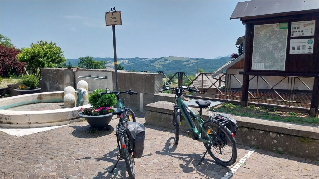
Today we’re starting our journey from Verghereto. We leave the car in the parking lot on the right before the bend—90 kilometers lie ahead to reach Rimini. So the plan is to leave the car here overnight and come back to pick it up tomorrow.
Before leaving, we take advantage of the fact that the small village grocery store is open to buy a couple of sandwiches with finocchiona that we’ll eat later.
We take the old state road towards the Montecoronaro pass. The start is a downhill on asphalt for a couple of kilometers, then the road begins to climb through traffic-free woods and pastures.
We climb calmly, conserving the battery because the day is hot and on the long stretch to the sea that we’ll have to travel on the other side, we might run into a headwind, so it’s better to save it.
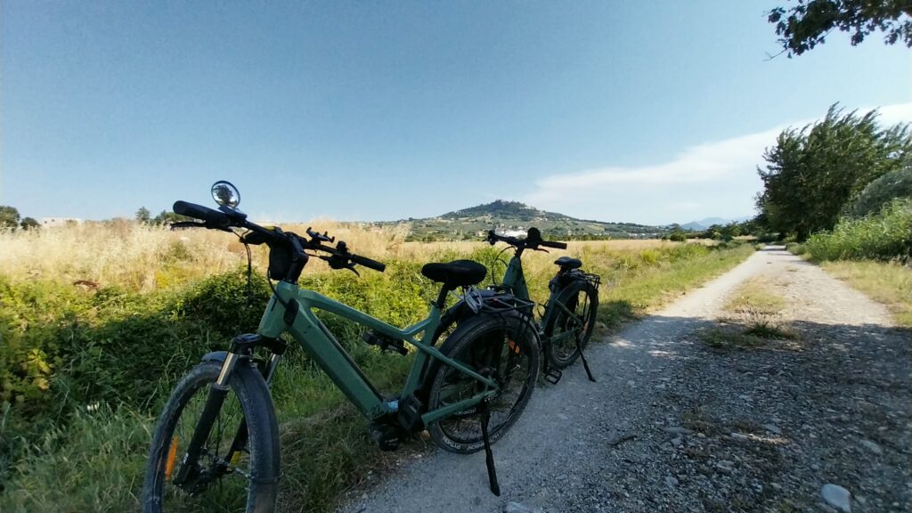
We arrive at the well-marked Montecoronaro pass (865 meters), and turn left to climb towards the village. We pass through the historic center with its stone houses and begin to ascend the hairpin turns that wind their way among the holiday homes.
Another couple of kilometers, then the houses end and we find ourselves pedaling alone through the woods, which at times open up to the abrupt calanchi that characterize these parts of the Apennines—barren canyons along which the trails for hikers begin.
We have climbed to about 1200 meters, but we are aiming for the 1400 meters of the Monte Fumaiolo pass that awaits us higher up. We continue to pedal on until we meet the road that comes up from Riofreddo, where we turn right and carry on.
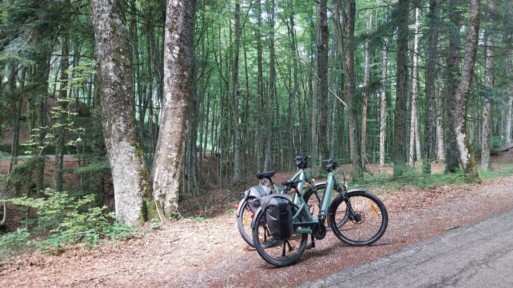
The vegetation soon changes, and when the still-paved road enters the deep forest and we are surrounded by very tall trees, we know we are close to Fumaiolo. The presence of a few motorcycles climbing the switchbacks and vacationers who have come to find some coolness also tells us that we are not far off.
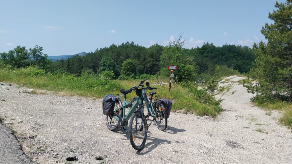
A couple of switchbacks and we’re at the Monte Fumaiolo pass: parking lots, campers, motorcycles, two restaurants. On the left side of the road there’s the start of the trail that leads to the sources of the Tiber River. It’s marked by a tourist sign and you can’t ride it by bike, it’s pedestrian only.
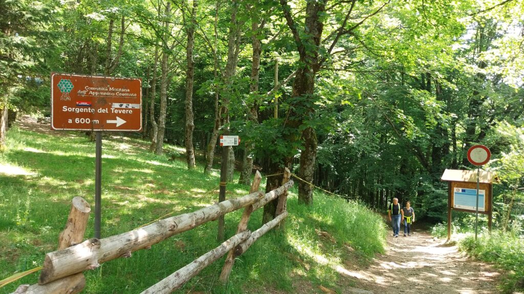
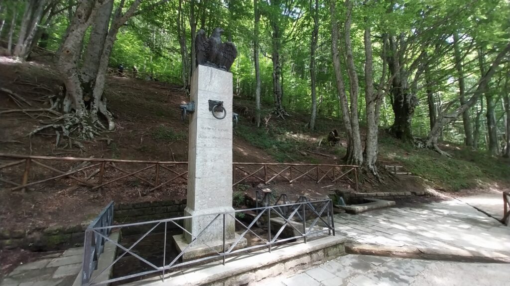
The trail is perfectly maintained and about 600 meters long. We tie our bikes to the fence at the beginning of the trail and start the descent into the woods, the stretch is short and in ten minutes we’re at the source, there are a few tables and since it’s almost lunchtime we decide to stop and eat the sandwiches we got in Verghereto, delicious.
We still have many kilometers to pedal to reach Rimini so we can’t take advantage of the shade, we climb back up the trail and get back on the road.
Monte Fumaiolo – loc. Giardiniera a Casteldelci (km 11 -> km 26)
We depart from Monte Fumaiolo for the steep descent that leads to Le Balze, 2 km of switchbacks to tackle with caution both for the road surface and for the cars and motorcycles that climb to the pass on holidays.
The descent is fast and in a few minutes we’ve already arrived at Le Balze. We thread our way into the small historic center to reach the main square which is basically a large terrace with a view as far as the eye can see towards the Tuscan part of the Apennines… while eating ice cream we’re already thinking about future routes to do on that side. But not today, it’s time to fill the water bottles and get back on the road.
One kilometer outside Le Balze the descent begins. Traffic is light, the road is paved and the wide switchbacks invite speed but it’s good to be cautious because the surface is bumpy in places. We continue like this for about 10 km passing through Senatello, Schigno and Mercato until we reach Giardiniera where the provincial road intersects with via Castello. To the left in one kilometer you climb up to the village of Casteldelci, we take a right to leave the Senatello valley and continue towards the Marecchia valley.
Casteldelci – Pennabilli (km 26 -> km 35)
The steep part of the descent ends shortly after Casteldelci, we continue pedaling and pass the bridge over the Senatello stream which is now on our right, after about 4 km the Senatello stream flows into the Marecchia river, another couple of kilometers and the road curves right to cross to the other side of the river, we’re officially in the Marecchia valley along the road that will take us to the sea.
We reach the junction with the Marecchiese state road, we turn left and follow it for about 300 meters, then when we see the café, we turn right to climb towards Pennabilli. It’s a fairly gentle climb 2 km long that will take us into Pennabilli, it’s the last effort because from here onwards it will be all downhill to the sea.
If you want to shorten the route a bit and avoid the climb to Pennabilli, you can continue along the state road for about 9 km to Molino Ponte Baffoni, certainly the road is more trafficked during the week and it’s good to wear a nice yellow jacket visible from afar.
We climb up to Pennabilli, and at the top of the hill, a cobbled street on the right, marked by an arch, leads us into the old village. We wander for a while through the narrow alleys, then step into the Orto dei Frutti Dimenticati (Garden of Forgotten Fruits), created by Tonino Guerra in what was once the vegetable garden of a convent. It is conceived as a true “museum of flavors,” meant to preserve ancient and nearly forgotten fruit trees.
It would deserve more time, but we’re not even halfway through our journey, so we soon have to get back on the road and continue toward Maciano.
Pennabilli – Ponte Baffoni – Novafeltria (km 35 -> km 50)
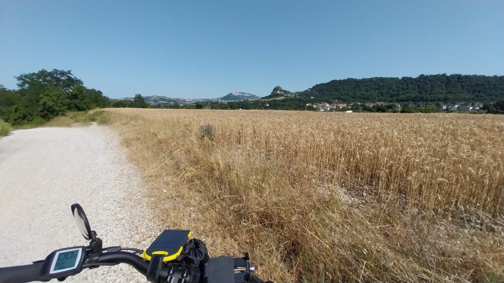
We chose the climb to Pennabilli to avoid, as much as possible, pedaling on the state road by making maximum use of secondary roads. After crossing Maciano we’re forced to merge onto the state road, but after a few hundred meters we can cut right towards Santa Maria and thus exit the traffic. The road we take runs a bit higher and allows us a beautiful view of the valley before putting us back on the state road, but we’ve almost reached Ponte Baffoni which is about a kilometer ahead, in the descent leading to the bridge you can see the Rocca di Maiolo in the distance.
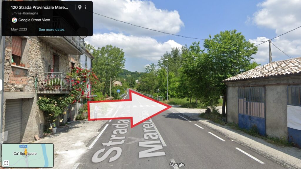
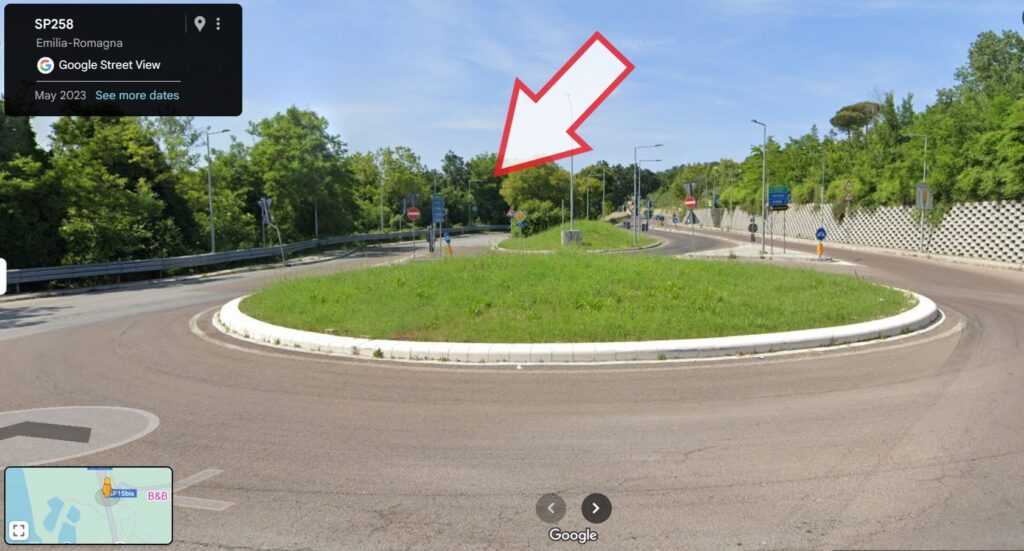
We cross the bridge and pass on the left side of the Marecchia. We pedal another few hundred meters straight along the busy state road and when we reach Ca’ Borgaccio, at the group of houses aligned along the state road, past a small storage facility there’s an unpaved area on the right. Be careful, there are no signs or indications but this is where you need to turn to leave the state road and start following the dirt road that runs alongside the Marecchia river.
And since we didn’t take a photo, here’s the turning point taken from Google Maps.
We descend towards the river, cross a bridge over a ditch and follow the dirt road, at a certain point we cross the provincial road and then continue straight. Novafeltria is higher up on our left, but we can barely see it. A few more pedal strokes and we’re at the entrance to the Ivan Graziani Park. You can’t miss it, with a huge pair of red glasses marking the entrance.
This is the moment to take a break to drink something cold taking advantage of l’Avamposto, the bistro on the river. A little further ahead in the park there’s also a fountain, perfect for refilling the water bottles. It’s good to stock up, the afternoon is hot and we’ve covered 50 km, there are still 40 to go to reach the sea.
Novafeltria – Pietracuta (km 50 -> km 62)
Inside the park we proceed calmly due to the presence of people walking around, moreover towards the end there’s a narrow and treacherous descent on the right that leads to the Arena sul Fiume which requires particular attention, but there’s the shade of the trees which offers a nice sensation.
Past the arena and the basketball courts the dirt road continues further then narrows and climbs abruptly towards the state road, the climb is sudden, narrow and steep. We don’t expect it… and we’re forced to get off. A few meters and we pick up the cycle path that runs alongside the state road for 200 meters then plunges right with an equally steep descent towards the road that runs along the river. We’ve left Novafeltria and now on the right you can see the imposing fortresses of Maiolo and San Leo.
We pedal fast, to cover some kilometers, towards Ponte Santa Maria Maddalena. About a hundred meters before the bridge you need to turn left and go back up onto the state road to avoid the last stretch of dirt road that leads to some steps going up to the bridge. It’s a minor detour, but it will spare you the effort of pushing the bike up the narrow stairs.
We cross the bridge which takes us to the right side of the Marecchia and immediately we slip into the large parking lot at the end of which we pick up the cycle path that runs alongside the Marecchiese state road, a few hundred meters and the cycle path descends on the left to get close to the river again which flows below.
From here we continue to Pietracuta where the cycle path goes up a short stretch of a tributary, crosses it on a small pedestrian bridge and resumes following the Marecchia.
Pietracuta – Lago Azzurro (km 62 -> km 79)
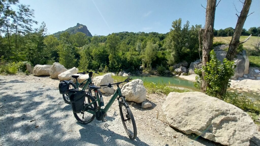
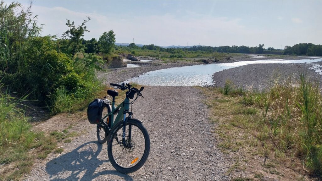
We follow the Marecchia for another 4 kilometers. Here, as in other points, the dirt road approaches and moves away from the river which is capable of eroding the banks very quickly during floods so it’s normal that often the route is further away and the river disappears from view hidden by vegetation.
A long right curve brings us back onto the asphalt of the state road. When we meet it we turn left, a hundred meters and a busy roundabout awaits us, we enter it and exit taking Via Dogana which climbs in front of us, and continues parallel to the main road. This way we avoid having to pedal in the middle of traffic. We proceed for a couple of kilometers then the road, which is closed to cars but passable with bicycles, sends us back onto the state road at a second roundabout.
We pay attention to cars and trucks and enter the roundabout. In front of us there are two roads that continue straight, the one on the right is the Marecchiese state road, which we want to avoid because of traffic, the one further to the left leads to Ponte Verucchio and that’s the one we take.
This is also a busy road, but the route tells us it doesn’t last long, in fact we pedal carefully for a kilometer then at the pedestrian crossing before the small roundabout we enter the cycle path on the right, we pass the roundabout, and immediately after the cycle path changes sides of the road. We cross and continue in a slight climb for another hundred meters. At the end of the curve, at the gate of a warehouse the cycle path makes a “U” turn into a descent closed by a barrier that blocks motor vehicles, on the left you pass with the bike and go down on a somewhat uneven dirt road. At the end of the descent we’re back on the dirt road alongside the Marecchia.
We pedal with the Marecchia River on the left and the view of Verucchio on the right. The dirt road is smooth and we proceed without too much effort even though the afternoon breeze rising from the sea is starting to make itself felt.
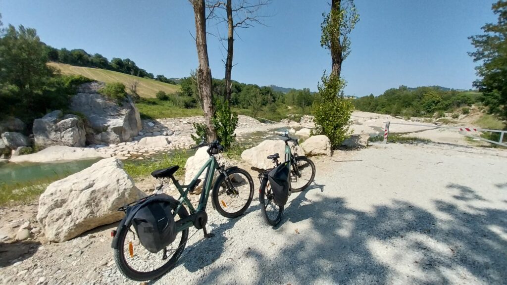
On the right we pass the Golf Club Rimini, Lake Santarini and Lake Azzurro then we find ourselves facing a barrier. A sign indicates the presence of work ahead and tells us to detour to the right to rejoin the Marecchiese state road. We don’t really want to end up pedaling on a busy and decidedly dangerous road for bikes, but we wouldn’t want to do kilometers for nothing only to have to turn back.
Someone comes by and tells us that part of the cycle path has collapsed into the river due to erosion of the embankment on which it was traced, while waiting for restoration work pedestrians and cyclists have carved out a passage further inland.
We check with Google Maps and indeed you can see the collapse of the cycle path and a track in the greenery further from the river. It’s just ahead, so we decide to go and see with our own eyes and decide on the spot if the passage is feasible. The river has eroded even more compared to the Google Map photos and has also eaten part of the pedestrian track, which is now reduced to a narrow passage about ten meters long: on the left a drop of about 4 meters into the river, dangerous to fall into, on the right a small hill of earth with very tall grass. In fact, only one person on foot can pass through carrying the bike by hand.
The day is dry and it hasn’t rained for days, so we decide to pass through carrying the bike by hand very carefully. If the ground had been wet and slippery, we would certainly have turned back.
The alternative if you should find yourself here with the cycle path still blocked is to turn right at the detour, go up via Savina until you cross via Casadei, turn left to go back down towards the river, follow it until it crosses via Valdazze, then continue to a barrier, which marks the resumption of the cycle path downstream of the landslide section, lengthening the route by about 2 kilometers.
Lago Azzurro – San Giuliano Mare, Rimini (km 79 -> km 90)
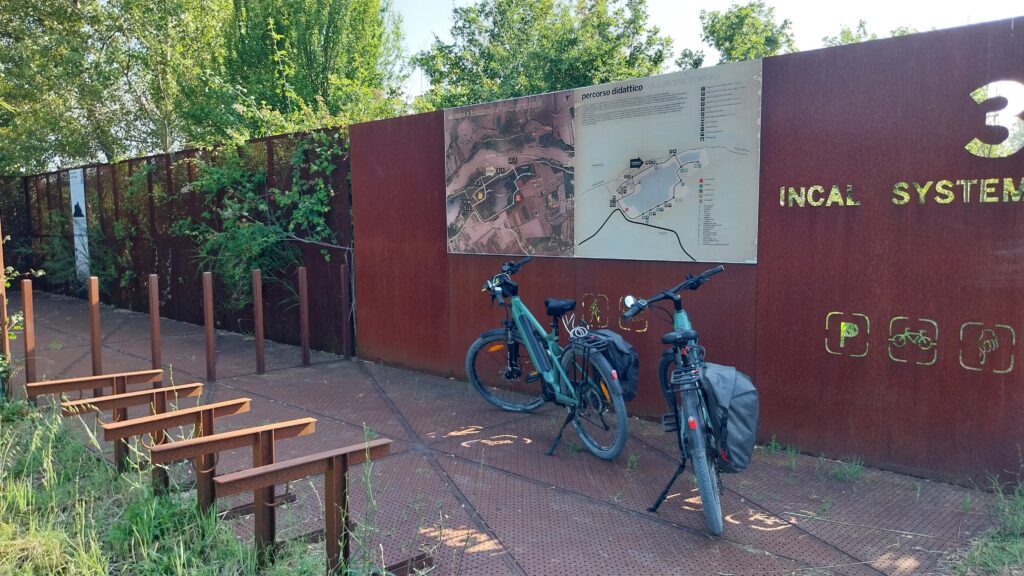
Past this obstacle we’re on the move again and on the right we find the lakes of the former INCAL quarry, beside the cycle path observatories have been built to watch the fauna without disturbing it, too bad the vegetation is so lush that from the slits you can only see leaves. Surely in autumn and winter something more will be visible.
From here we proceed quickly until we encounter the Parco degli Artisti, you can drink and eat, but our destination is the sea and we decide to go straight. The wind has been blowing in our faces for several kilometers now. It almost feels like going uphill so we raise the battery of the Mustache by one notch, which we had economized up to this point, to arrive at the beach soon.
Here the cycle path runs wide, in a few kilometers we pass under the highway and state road no. 16 Adriatica. Right after we find ourselves having to cross the Marecchia overflow channel where, to take the crossing bridge, the cycle path ends in a bottleneck cluttered with rubbish and where the handlebars almost touch the walls on the sides. If we had had two full side bags, we wouldn’t have been able to pass. Fortunately it’s a short passage of about 10 meters, but once again we wonder how it’s possible that the administrations, faced with important and appreciable cycle path and cycleway projects like this one along the Marecchia, then get lost in the details.
The sea breeze now is no longer bothersome, it’s a relief that calls to us and reminds us that we must continue pedaling. We’ve now reached the city, houses on the right and the Marecchia on the left. On the embankment people are returning home from the beach in swimsuits. A nice contrast with the woods at 1400 meters of Monte Fumaiolo from which we departed 6 hours earlier.
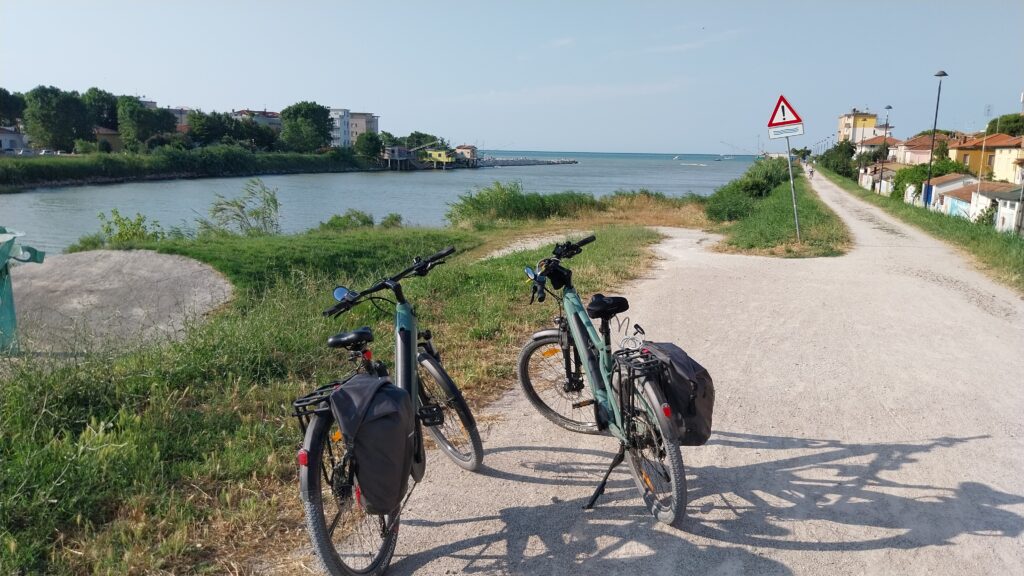
We’re close. Now we can relax, passing under a couple of busy roads and the railway, then the Marecchia suddenly reveals its mouth, which flows into the Adriatic Sea next to the San Giuliano beach in Rimini. After 90 km, we’ve arrived.
A short ride on the beach, touching the sand, and along the promenade behind the beach clubs all the way to the Rimini marina helps us get back on the ground after more than six hours spent, almost all of it, on the bike.
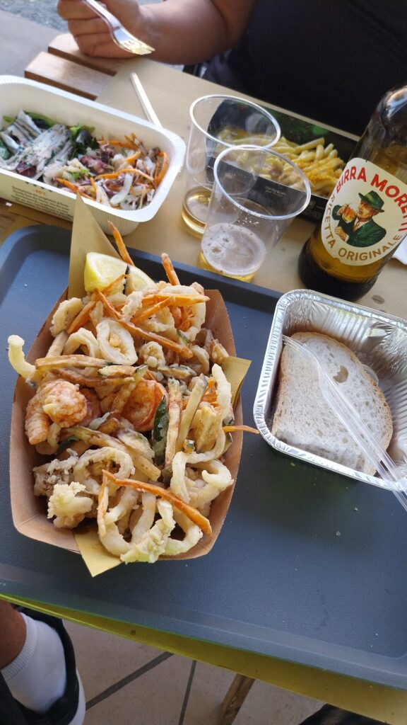
While we’re thinking about a next ride to ride the other side of the river, evening approaches and it’s time to collect our final reward: a couple of cold beers and a fritto misto in Rimini.
Recommended stops
- The Sources of the Tiber River at Mount Fumaiolo
- Pennabilli – Orto dei Frutti Dimenticati
- Viewpoints along the Marecchia Valley Cycle Path
Where we ate
- L’Avamposto in Novafeltria
- Il Cucinotto in Rimini
Places we passed through
- Verghereto
- Montecoronaro
- Monte Fumaiolo
- Le Balze
- Casteldelci
- Pennabilli
- Novafeltria
- Ciclabile del Marecchia
- Pietracuta
- Villa Verucchio
- Rimini
Download GPX file
gpx route from Verghereto to Rimini